Overnight I wondered if the cache behind the locked gate was being reached from the beach side. I drove back to Marina and tried to find where the trail presumably exited to the water. The beginning wasn’t promising.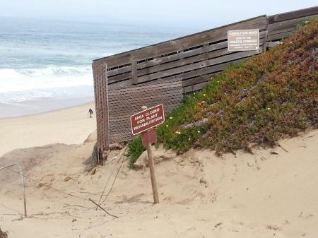
Cables with signs stretched down the beach.
Finally, there was a small unblocked gap. The climb up was steeper than it looks in the picture.
This was the view inland from the top. If ever there was ever a sensitive area where people shouldn’t walk, this was it.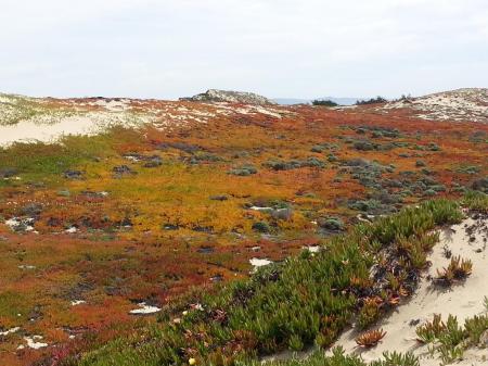
It probably would’ve been possible to reach the cache and the wrong side of the locked gate. Instead I enjoyed the view and climbed back down.
The geo map showed a cache on the other side of the parking lot. At least the trail there was open if somewhat buried.
The dunes there were less colorful. The trail is on an abandoned boardwalk.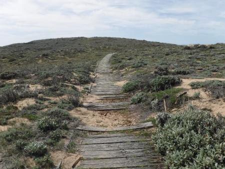
My GPS agreed with the hint on the geo-page, at the red “X.” I rooted around for a long time but logged a DNF’d (Did Not Find). The cache owner contacted me the next day and said he found the container buried 1’ deep. Buried geocaches aren’t allowed by the rules of the game but considering the location, it’s unavoidable here. He moved it to the base of the pole holding the cable. I’ll get to it on my next trip.
With no luck geocaching I drove to a nearby park to try MAGNET FISHING. There’s a lake in there.
Access points were few and all of them were filthy. After completely circling the lake I gave up and drove back toward Monterey.
Halfway there I saw another lake just off the main street. 20 feet from parking I found a secluded section of walkway and dropped my magnet. The water was 8’ deep. Within seconds I felt the heavy click of metal and pulled up the bottom rack of a shopping cart. Note the crawfish on the right side who rode along from the bottom.
He was very very angry and snapped his claws at me. After the picture I plopped him back into the water.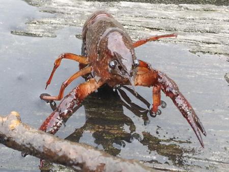
In 15 minutes and only 2 steps in each direction from the starting point I found all of the junk below. The fishing hook, carabiner and Mexican coin looked new when wiped off. But everything reeked of sulfur. I dimly remembered that that type of rotting stench is produced by bacteria but not if it’s especially dangerous. I trashed the big pieces, bagged the small stuff and continued back the hotel. In the future I hope to find more interesting things like multi-tools, knives, fishing gear, etc…
Wind gusts grew stronger all afternoon long. I would’ve set up my ham radio loop antenna and tried to contact Pacific islands and Australia if the air was calm.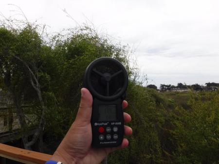
Instead I walked 2 blocks to the beach at Cannery Row. Last year on a walk through, I noted lots of sea glass there.
This time in full view of the restaurant diners above I spent 20 minutes collecting. Several other people did the same.
For now, all that I collect is accumulated in a glass jar for yet-to-be-determined future projects.
APRIL 22, 2018 – MARINA-2
April 22, 2018
 Leave a Comment » |
  Uncategorized |
  Permalink
 Posted by oldweeb
APRIL 17, 2018 – Point Lobos & Marina-1
April 17, 2018After almost 3 months of mostly vegetating indoors I took a much needed 5 day trip back to the Monterey area. The first main activity was hiking in Point Lobos State Reserve.
I started with an inland leg, skipped for time last year. The sounds of Hwy 1 traffic faded as the trail led toward the ocean.
When turning to face a large movement in the bushes (Ewoks?) I walked into a hanging branch of poison oak. Of course, the only person I saw on this part of the hike rounded the corner at that moment. A know-it-all, apparently seeing me as a foreign tourist, he tried to explain poison oak and Tecnu in ‘easy English.’ I said, “I’m immune,” and kept walking to a bench where I sat down to use alcohol wipes, just in case. Minutes later poison oak was forgotten as the ocean came into view.
The trail emerged at Bird Island. Maybe it was the wrong time of the day or year but there were only a few birds, not the thousands that I’d hoped to see.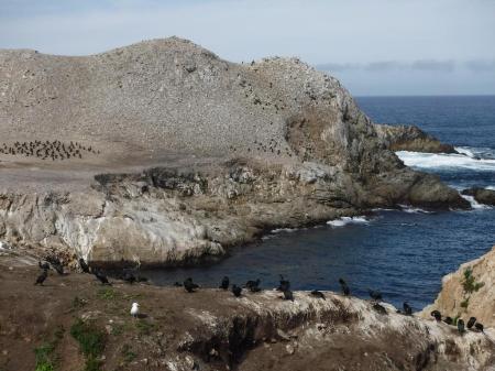
On a steep ledge was an example of my favorite species, the https://en.wikipedia.org/wiki/Black-crowned_night_heron Black Crowned Night Heron. I’ve also seen them at San Diego Bay and in the Sepulveda Basin in Van Nuys. They’re nocturnal hunters. At 2’ tall they’re hard to miss even when zoned out during the day.
Pairs of harbor seals, all 1 large & 1 small, swam slowly below this viewpoint. Mothers with pups?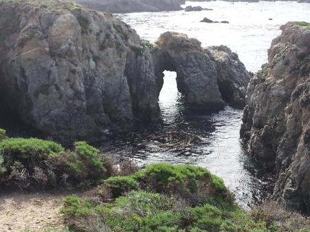
Visitors gravitate to the more famously scenic forested North and South ends of the reserve. That leaves the middle tidepool area mostly muggle-free.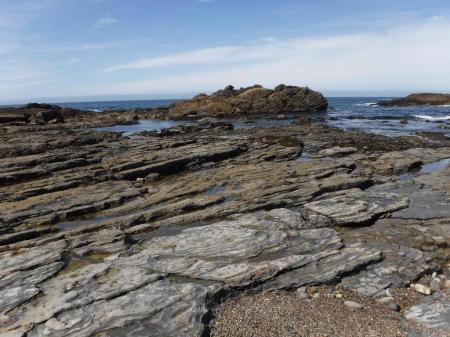
Last year, early in my rock tumbling hobby, I was disappointed that rock collecting is prohibited.Since then multiple trips to less restrictive beaches gave me the experience to identify the best and worst tumbling rocks. The ones here erode out of the cliffs.
And all were poor tumbling candidates. It was easy to walk away with empty pockets.
Two hours earlier, parking was hard to find. Now half of the spaces along the shoreline trail were open. Hint, early mornings are crowded. Mid-days, far less so.
North end views were as remembered. This time there were fewer tourist muggles and no need to wait for prime photo taking positions.
Sea lions barked. In the distance whales spouted and swam North. Bring binoculars! At a place like this you won’t look dorkish with them hanging around your neck. Those without will be envious.
Last year I had no patience to log the 3 shoreline earth caches. This time I was ready. But they’d been archived in the interim, another sign that the geocaching hobby is declining.
I enjoyed the views again on the reverse hike back to parking.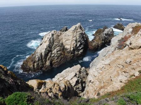
At 1pm I drove 15 minutes North, through Monterey to the City of Marina. I found a geocache at the edge of a beach parking lot that I’d DNF’d last year and then tried metal detecting. My Garrett AT Pro sits for months between each use. Something seemed to be broken. Even with new batteries (4 x AA alkalines) it was erratic. Finding nothing, I dropped test coins and they weren’t detected correctly.
I switched back to geocaching and drove one block to a cache I’d tried to visit 3x over the years. Again, the trailhead was closed. Finds are being logged by people who go over or around the gate. Not me!
Beyond the cul-de-sac end of the street, 3 new caches in a row were in an area that I thought was also closed. A careful look behind sidewalk trees led to a ‘hidden’ open trailhead!
I hurried to beat the impending rain, pleased that nothing hurt after hiking & ‘hobbying’ outdoors all day.
The first 2 caches were difficult vegetation hides found only after reading the hints. The third was an old Play Dough container easily found at the base of a fence post.
I returned to the hotel just as it started sprinkling. Still feeling energetic, I set up my Alex Loop ham radio antenna and low power transceiver in my room to test it for the next day. Unfortunately there was extremely heavy manmade static across all frequencies. This indicated the nearby presence of a lot of cheaply made unshielded electronics, especially wall-wart chargers. Only a few super strong ham stations were heard over the static. There was no way they’d hear my puny signal.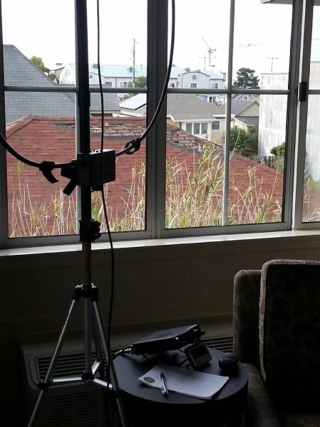
During a break in the rain I walked outside to find dinner. My vacation meal rule is to eat local. No chain restaurants. One block from my hotel, the seafood chimichanga was great as was the pizza the following night.
Leave a Comment » | Uncategorized | Permalink
Posted by oldweeb
JANUARY 21, 2018 – FIELD ROAD SIDING (between Yermo & Baker)
January 21, 2018Last month on my way home from Primm, Nevada, I pulled off of the I-15 multiple times to find freeway-close caches. About half way from Baker to Yermo I took the Field Road offramp and looked for 3 caches on the south side. The first one was Road Not Maintained (GC4QEX).
At all 3 caches I noticed that the ground was strewn with interesting rocks, many of which I knew would tumble well. But after a week of rock hounding and geocaching I was too tired to collect anything and hurried home instead. During the next 2 weeks I read that “Field Road Siding” is a famous rock hounding site picked over by collectors for a hundred years. Small pieces (just what I want for tumbling!) were reportedly still abundant and collectible specimens could still be found if one looked carefully.
I took advantage of the warm clear weather and the Martin Luther King holiday to return to Field Road. Just beyond the last cache I’d found 2 weeks earlier, the terrain looked like this.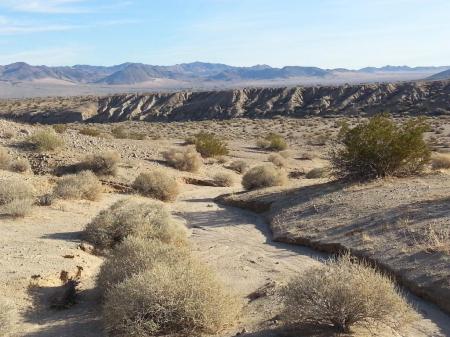
Light rain a few days earlier washed off the rocks and there was still enough moisture to hold down the dust. I quickly started to collect 1” to 2.5” rocks. They’d been ignored by generations of specimen collectors and lapidarists who took only larger rocks. I even found another cache in the middle of the rock field.
I’d started in mid afternoon after arriving directly from home. Still, I quarter filled a canvas shopping bag and found 7 geocaches before sundown.
Early the next morning I drove from my usual Barstow motel back to Field Road. This time I went to the north side of the freeway. Following directions in Gem Trails of Southern California, by Otie Braden, I drove 1.2 miles to a site with even more rocks than the previous day.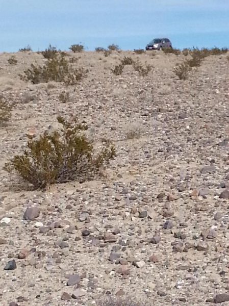
The farther away from the dirt road, the better the choice of quality rocks. Here’s one I found about .35 miles out. It’s too big for my tumblers but a specimen collector would probably want it.
There were no geocaches here but other oddities were seen.
I wondered how and when this rolling pin ending up in the middle of the Mojave.
Three hours and another half bag of rocks later I cached along a dirt track that eventually turned into a paved but strangely dilapidated and deserted section of Yermo Road. It was only miles later when I drove up to the back side of road closure barricades that I knew the reason why. 
I ended the day with 7 more geocaches.
The next morning (Monday) I checked out and drove west on the newly extended Hwy 58 and exited on unpaved Helendale Road. Then I turned south on Open Route 4800 which is arrow straight for 20+ miles to the eastern edge of Lancaster. This shortcut isn’t recommended for 2WD passenger cars due to sandy or (uninteresting) rock filled stretches. On the way I stopped for caches skipped on earlier trips. One was in a giant tire near a more attention grabbing half-boat. A cautious look inside revealed no homeless person. Then insights were gained about boat construction and flotation.
Here’s a Halloween themed cache.
This one was guarded by another rigor mortise tortoise. I see far too many of those.
Two plastic ammo can caches were weathered on the outside but clean and new-looking inside.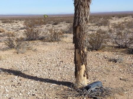
At home I washed off my collected rocks. These 2 pieces of petrified wood were my best finds. They’ll be kept as-is and not tumbled.
I tumble most of the rocks I collect. Very few flawless examples result. About 75% are good enough to keep or give away. The ones pictured below are jaspers from my November trip to Lavic Siding (see previous post). They have some holes and rough spots but I still like them because they’re self-collected.
I’m accumulating tumbled rocks for a post retirement (8 more years!!) lapidary sideline hobby.
1 Comment | Uncategorized | Permalink
Posted by oldweeb
December 30, 2017 – Back to the Desert
December 31, 2017I spent the final week of the year back in the desert. Barstow again and then the Nevada border. From my usual Barstow base motel my first excursion was to Route 66. This was a rare trip where caching wasn’t the primary activity. I made an effort to see the sights. Here’s a fading sign from another era.
The Bagdad Café occupied the other end of the lot. My Garmin Oregon’s compass arrow pointed to a cache, apparently inside the building. Nope, not for me. I kept going.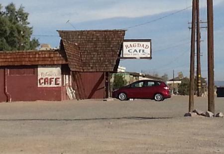
Next was Pisgah Crater where I found a cache that was unreachable in November due to muggles. This time no one was around and it was an easy 2 minute walk across the lava to an ammo can.
Four miles farther east, back at Lavic Siding I spent 2 hours carefully looking for more rocks (jaspers) for my tumblers. Again I was astounded by the sheer amount of material laying out in the open.
I was even more selective than in November’s trip because so many of the rocks collected then didn’t tumble well. Here’s what I took home this time. They’re smaller and have fewer hard-to-tumble-away defects.
That night I’d planned to watch Star Wars at the theater across from the motel. But the parking lot was full for the final showing at 8pm. Instead I watched TV reruns. The next morning I left for Primm, Nevada, stopping for Alien Fresh Jerky in Baker. They’re building a UFO themed hotel behind the store.
I arrived in Primm at noon. While waiting for the 3pm check in time at Primm Valley Resort I drove onto the dirt road behind the outlet mall along the state line and border of Ivanpah Dry Lake.
Others report caching there in 2WD rental cars but I was extra glad to be in my AWD Subaru Forester with AT tires. Caches were easy finds with no real need to be well hidden. I kept saying to myself, “just a little farther for the next one,” and…
…emerged onto pavement in Nipton California, a super small town recently in the news. The only sign of the impending changes there was a green flag. The word “green” was visible on it. Then I found a cache in the parking lot that I DNF’d in 2010. At 3pm I returned to Primm by paved road and I-15.
The next morning I drove back through Nipton and again into Nevada.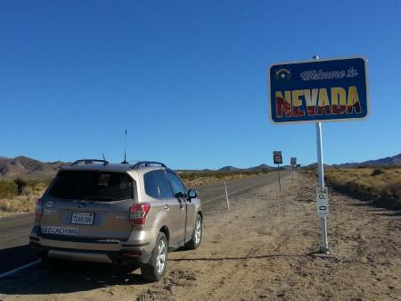
My caching target was a section of the El Dorado series. There are apparently several thousand numbered off road caches. The first one reached was 228 – El Dorado! (GC4DTG9). The trail went ever upward and parts were VERY rocky. Definitely don’t try to drive here in a Prius. I never saw so many Joshua trees, yuccas, and multiple cactus species. Somehow I managed to NOT shed blood.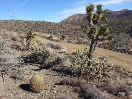
The hides were all in small rock piles on the W side almost all within 5 feet of the road’s edge. The cache name number decreases Northward. At about #200 the uphill ends, replaced by undulations and then relative flatness. Because of general stupidity I switched directions 3 times. And due to a defective pocket query that stopped at cache #170 I found less than 70 series caches. With an earlier start and complete pocket query I would’ve easily found 100+. Oh well. I enjoyed the scenery. Note the robust Joshua trees. They’re very different from the mostly sad droopy specimens seen in Palmdale and Lancaster.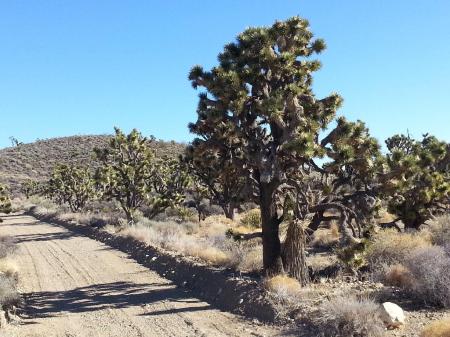
The cache road, was a powerline utility road. Signs indicated “Designated Route,” OK for recreational use. But in the 4 hours I was there no one passed in either direction.
I was disppointed to return to Primm with daylight still remaining. Oh well, there’d be more caching the next day…
Leave a Comment » | Uncategorized | Permalink
Posted by oldweeb
NOVEMBER 29, 2017 – (near) FORT IRWIN & KRAMER JUNCTION
November 29, 2017As sometimes happens at my Barstow motel, I awoke at dawn to the sound of motorcycle engines revving and their riders shouting greetings to each other. Some people just don’t care. The commotion stopped me from going back to sleep and I was soon on the 15 fwy. At the nearby Fort Irwin Road offramp I drove toward the fort on the ultra well maintained 1 lane non-freeway. The lack of traffic going my way made it easy to stop and look for roadside caches. The one here Cave to Nowhere (GCHFG7) was different. It was 400’ off road and reached via a side road. The GPS compass stubbornly pointed directly at the cave. Even though it’s only 20 feet deep I wasn’t going inside. I was more afraid that someone used the cave as an outdoor toilet than of any physical danger. Luckily for me a prior finder re-hid the cache 25’ to the left of the entrance.
Returning to the road, a few miles later I stopped at “Boring” and turned east, off road.
The rocky dirt made me glad that I drive on all-terrain tires. This is “Who Cairns.” For the 3rd time, “Resting Rattler” didn’t appear on my Garmin’s screen. The image (a small snake) in the cache name stops it from showing onscreen. Next time I’m going to write the coordinates on paper. Then I worked my way up the tail end of the alphabet series until I reached my own cache, “Lick-A-Lizard,” which I retrieved and archived.
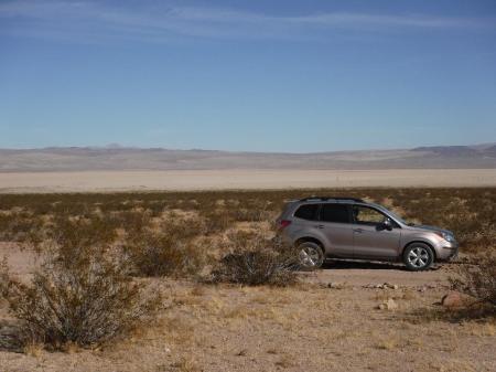 There was enough remaining daylight to drive back to Barstow and then 30 miles east to Kramer Junction. From there I drove south peeling off to either side to find caches.
 A f0t0m0m cache involved hiking to the top of a low hill. It was a good place to view the surrounding terrain.
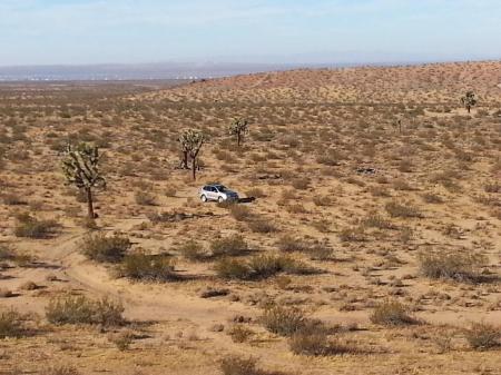
Some caches were interesting containers that wouldn’t last a day in less remote areas. On this one the log is in the Altoids tin on the dog’s right side. I’m not sure what this is supposed to be. The cache is in a container in the black tube. The metal box is screwed shut and sounded empty.
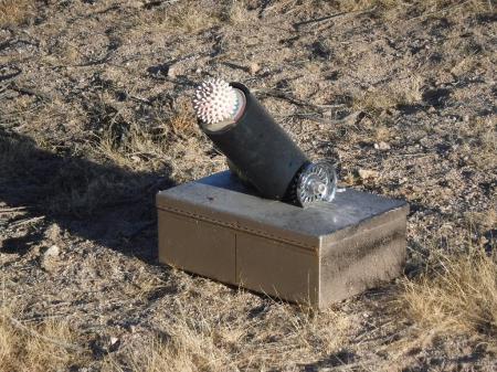 In 2 days I found 2 + 24 caches and a bunch of rocks for my tumblers. Weather permitting, I hope to go back to the desert again next month.
Leave a Comment » | Uncategorized | Permalink
Posted by oldweeb
NOVEMBER 28, 2017 – LAVIC SIDING & PISGAH CRATER
November 28, 2017After Thanksgiving dinner I drove to my standby motel in Barstow eager for an early start in the morning to rock hound at the world famous Lavic Siding jasper fields. Most newbie rock hounds would’ve been out of their element. But as a desert geocacher the 45 mile drive on Route 66 felt comfortably familiar. The turnout for Lavic Siding is at geocache 155-Route 66 (GC2JXWB). I parked only .25 miles in, planning to hike a circle while looking for jaspers for my rock tumblers.
 Immediately I saw that no hike was needed. The ground was COVERED with red, yellow and red-yellow jaspers. This is the view at parking.
 I walked about 500’ away in each direction, collecting on my walk back and then depositing in my Subaru. The sheer abundance of jaspers was overwhelming and I wanted to grab everything. It’s legal to take “reasonable amounts” for non-commerical personal use.
 After a few minutes I became selective and avoided rocks with extreme shapes, visible fractures, deep holes or pits. I took home about 15 lbs to fit in my table top tumblers. Here’s the first batch.
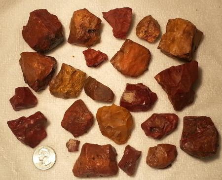 The afternoon was spent 4 miles west, geocaching at Pisgah Crater.
 Here’s ground zero at a lava outcropping. The cache was a rodent-chewed decon container.
 And a sea of untumblable volcanic rocks was underfoot.
 The next cache was a DNF and the one after that was in a lava clearing.
 More caches were ahead but so were a dozen wildly speeding quads on the narrowing road. Instead of risking a collision or breathing volcanic dust I went back to Barstow to recharge for another day of geocaching.
Leave a Comment » | Uncategorized | Permalink
Posted by oldweeb
SEPTEMBER 26, 2017 – ARCHIVING AHMANSON
September 26, 2017Nine years ago I placed 7 caches on the North/South trail in the area formerly known as Ahmanson Ranch, beginning at the North terminus of Las Virgenes Road. One was archived later because bees made a hive inside the attachment structure. The remaining 6 stayed active for 9 full years with only 1 muggling until I retrieved and archived them this weekend. That’s (6 x 9)= 54 cache years! Why archived? 9 years is a long time and new find logs were increasingly few and far between. And the containers needed to be retrieved while I’m still physically able to hike (slowly) and not left as geo-trash. The 6 mile roundtrip hike started here:
The strong natural sulfur stench just beyond the trailhead triggered memories of crowded past hikes where muggles sometimes turned around and left in disgust. This time the trail was empty except for about a dozen mountain bikers.
It felt great to be outside in less than 3 digit heat. My first stop was at this hollow on the East side of the trail. It’s ground zero for someone else’s cache – that I couldn’t find. Missing?
Continuing North I passed the location of the archived bee-invaded cache. It’s bee-free now and the structure is ready for someone else to attach a magnetized cache container.
Most of the trail was brown. Only a few short sections were green.
I retrieved 2 caches and the 3rd was muggled. The 4th was a still-in-place decon container in the pipe/pillar, lower center below.
On past hikes I’d noticed some rectangular concrete posts scattered along the trail. I finally realized that they’re old hitching posts with their metal rings broken off.
The hike was mostly flat with the only noticeable elevation change about 2-1/2 miles in, approaching cache #5.
After retrieving #5 and #6 I kept walking 0.18 miles beyond to Skippy is a Little Less Lazy (GC75K3H) to find and log it. Then I hiked back on the same trail. At the midpoint I saw a jumbo size coyote walking ahead on the trail. Do I have a picture? Yes, but no one wants to see a blurry coyote butt. A shouting, speeding biker scared it off.
Here are the retrieved & archived cache containers. All are the original ones I placed in 2009. They’re in surprisingly good condition and might have lasted another 9 years.
I plan to retrieve and archive my 26 remaining caches by the end of the year.
1 Comment | Uncategorized | Permalink
Posted by oldweeb
July 23, 2017 – A Big Change
July 22, 2017Dweeb’s Diatribe is approaching its 10th anniversary. In those 10 years I wrote 222 posts about almost as many geocaching expeditions. But all things must end. Changes to how the game is played and the general deterioration of the socio-political climate make caching far less enjoyable. My caching has slowed to a trickle. I no longer attend events and I’m well on my way to archiving or adopting-out all of my caches.
But I still enjoy being outdoors and know that it’s essential to maintaining good health. Taking full advantage of navigation and outdoor skills honed by geocaching, I now participate in some related and mutually complimentary hobbies like desert & beach rock hounding, rock tumbling, metal detecting and amateur (ham) radio. I’m changing Dweeb’s Diatribe to add all of these. I still plan to geocache occasionally, especially in the desert where I can also look for tumbling rocks at the same time.
For those who are only interested in reading about caching, sorry. I’m continuing the Diatribe, even if no one else reads it, so that it’ll be my hobby diary to enjoy when I’m old and homebound. And maybe reading and remembering will stave off dementia.
If you’re a regular reader who’s going away, thanks for staying as long as you did and for your comments, here and on Facebook.
1 Comment | Uncategorized | Permalink
Posted by oldweeb
MAY 19, 2017 – Rosamond (Kern County)
May 18, 2017Last weekend I combined geocaching with my new rock tumbling hobby. I drove 55 miles N, mostly on the 14, to Gem Hill in Rosamond. It’s a famous location for rock hounds because it’s public land and collecting rocks is completely legal. Familiarity with Google Earth from geocaching was a huge help. Not only did it lead me to a wide open parking spot, it showed me an easy mostly flat ½ mile hiking trail around the back side of the hill.
The hike led here, where I’d seen the green ground cover on the satellite map. There was much evidence of previous digging. Inexplicably there were no geocaches.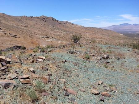
Youtube videos and online posts showed/described other rock collectors using shovels, sledgehammers and even a gas powered jackhammer to break rocks from exposed veins. I just picked up scraps that they missed. Visual scanning, another skill honed while geocaching was extremely helpful.
In 2 hours I collected enough rocks to make several batches of tumbled (polished) rocks and walked back to my Subaru. On my way to a MASSIVE cluster of caches, the Old Dusty Road series, I stopped for a closer look at an especially healthy Joshua tree.
They’re in bloom now. Or do pods count as blooms? I’ve heard that they’re edible but look closely. Those white wormy looking parts aren’t very appetizing. Near the SE intersection of the 14 & Backus Road I started caching at a random dirt road. Traveling was easy. And with both the 14 visible to the W and Sierra Hwy to the E there was no danger of being stranded without help.
The first cache, ODR’s #812 (GC7484B). It was an easy find only a few steps from the road as were half of the other 20 caches I visited. What’s “XMD?” It’s the Facebook mega-group “Explorers of the Mojave Desert.” And the magnetic “Geocaching” sign is for suspicious locals and law enforcement in case they drive up behind me. They might still demand to know what I’m doing but at least their first thought won’t be, “trash dumper,” “tortoise poacher,” or something similar.
Unlike most other desert series I’ve visited, the caches I found here were all camo’d and almost all in tough scratchy bushes. To be fair to the hider there weren’t many rocks or pieces of loose vegetation available to make geopiles. I DNF’d many because I didn’t want to rip up my hands reaching for containers I couldn’t see.
On the way back to Backus Road (fwy onramp is at the left edge of the bridge) my final find was a large non-series cache, Red Castle (GC71ETG).
There was a geocoin inside, the 3rd one I found on this trip. All 3 were old and owned by Jim, “f0t0m0m.” Maybe he dumped his collection into caches. He surely knows that the coins will inevitably disappear soon, taken by casual players who don’t know what to do with them. I DO know what to do and will drop them into non-urban caches in the hope that they’ll remain in circulation longer.
1 Comment | Uncategorized | Permalink
Posted by oldweeb
APRIL 26, 2017 – Point Lobos (Monterey County)
April 25, 2017When I vacation in Monterey I try to expand my knowledge of the area by taking day trips farther afield. This time, only a mile beyond my previous southernmost excursion I reached Point Lobos. The geocaching map showed multiple earth caches and multis in the State Reserve. Page comments indicated that no physical caches are allowed. The multis had numerous (too many for me) stops to gather clues for cache containers hidden outside the reserve.
I don’t like to spend outdoor time, especially on vacations, compiling clues/data for earth caches and multi caches. It was especially true for this visit because I wanted to enjoy the great scenery and easy hike I’d seen featured online. The “lot full” sign at the entrance was ominous. And the 2 cars ahead of me turned around and exited. I expected to be turned away. But the entry booth ranger said there were still open spaces and waved me through on my California Explorer entry/parking pass. Apparently the turned around cars didn’t want to pay the $10. fee.
A short drive through a gloomy forest led to a series of small beachside parking lots. I stepped out at the third one and walked to the waterline just as it started to sprinkle. The view wasn’t especially good.
What I noticed the most was what was underfoot. It was either heaven or hell for a new rock tumbler like me. There were more great rocks than I could possible tumble in multiple lifetimes but they were strictly illegal to take according to multiple posted signs. I ended up with a handful of crappy ones from the Cannery Row tourist beach 18 miles away.
After poking around the rocks I joined the tourist muggle stream walking north on a well marked trail. The sprinkles stopped and the view improved.
Here are the muggles ahead of me. The ones near me looked oddly at my twin hiking poles. I’m sure they became envious when I walked steadily uphill over broken ground and uneven wooden steps while they struggled.
The views improved even more with increasing altitude and sunlight. Somewhere below a lone sea lion barked.
An abrupt end to the trail made me turn inland to find another one.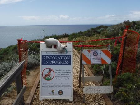
There, poison oak and its folk remedy mugwort grew abundantly together. I saw only 1 small warning sign. I feel sorry for people who don’t see the sign or don’t read English and unwittingly brush the PO.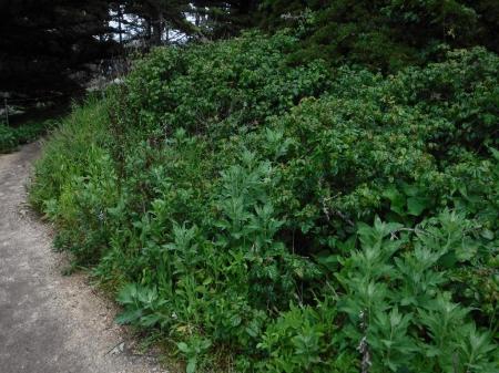
Side trails each led to a viewpoint. I knew that every stop contained clues for the multi caches and/or earthcaches but instead of looking for them I enjoyed the scenery. Except for a rude (Russian?) speaking family picnicking against the posted rules and hogging this site, everyone else politely took their pictures and moved aside.
Just when I thought that there couldn’t possibly be better views, there were. Oddly, most of the muggles had turned back apparently unwilling to hike around the mud puddles from rains earlier in the week. Wimps!!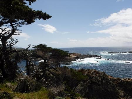
They missed this too! Now, nearly alone, I wished that I’d printed a list of the multi-cache clues to find. Oh well.
I enjoyed a final shoreline view of gnarled tree cover before the trail looped inland back toward the parking lot.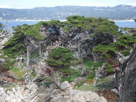
Next time I’m going back to see what I missed behind the temporary closure sign and to explore the inland parts of the reserve. Maybe I’ll even attempt the earth caches and multis.
1 Comment | Uncategorized | Permalink
Posted by oldweeb


